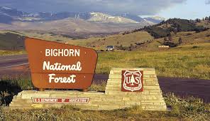
 Sheridan, WY May 21, 2021 — With the Memorial Day holiday approaching, it’s time to officially kick off the summer outdoor recreation season in the Bighorn National Forest.
Campgrounds currently open include Leigh Creek, Ranger Creek Recreation Area, Shell Creek, Middle Fork, and Loop A in Sitting Bull. If weather permits, North Tongue, Boulder Park, South Fork, Tie Hack, Owen Creek, and Prune Creek campgrounds are expected to be open for Memorial Day weekend.
Campers in the Bighorn National Forest are reminded to bring their own drinking water, since water systems may not be tested. Fees are reduced when full services are not provided.
Other Bighorn National Forest campgrounds, trailheads, and picnic areas will open in June as soon as weather and other conditions permit. Wet conditions may delay access to some facilities.
The Bighorn National Forest would like to encourage everyone to “know before you go” as a first line of defense for staying safe in the forest this summer.
Whether you’re visiting the forest for wildlife, wildflowers, ORV riding, hiking, fishing, or just taking in the view, it’s important to keep some safety tips in mind.
Be prepared to share the forest with wildlife. Bears have emerged from their winter dens and are looking for food. Mothers with young are especially protective. For your safety and to protect wildlife, photograph and watch wildlife from a distance, and keep a clean camp and dogs under control.
Be aware of flood hazards no matter where you travel. Even small streams and creeks, dry streambeds, and low-lying ground that appear harmless can flood with little notice. Travel routes and crossings become impassable due to wet and muddy conditions, so if the road or trail looks too soft to support your vehicle, turn around. It is illegal to drive off-road to avoid a snowdrift, mud hole, or down trees.
Motorized travel in the national forest is allowed only on signed, designated routes. A Bighorn National Forest motor vehicle use map is the best way to know if you’re on a legal route. Along with other map information, a free map is available online at https://www.fs.usda.gov/main/bighorn/maps-pubs.
If you own a mobile device, you can take the Bighorn’s motor vehicle use map with you. Information about downloading the app and the map are on the Bighorn’s website.
Motorized travel is allowed within 300 feet from the centerline of most motorized routes for the purposes of firewood gathering, camping, and game retrieval and resource damage does not occur.
Springtime is when roads and trails are most vulnerable because wet conditions make it easier to damage soils. Travel routes will be open as soon as is safely possible, depending on snowmelt and weather conditions.
Current hydrologic outlook, snowpack, and flood risk information is available from the National Weather Service website at https://www.weather.gov/crh/.
For more information about forest conditions and to find out if your favorite road, trail, or campground is open, contact the Powder River Ranger District in Buffalo at 307.684.7806, the Medicine Wheel Ranger District in Greybull at 307.765.4435, or the Tongue Ranger District in Sheridan at 307.674.2600. Follow us on Twitter (@BighornNF).