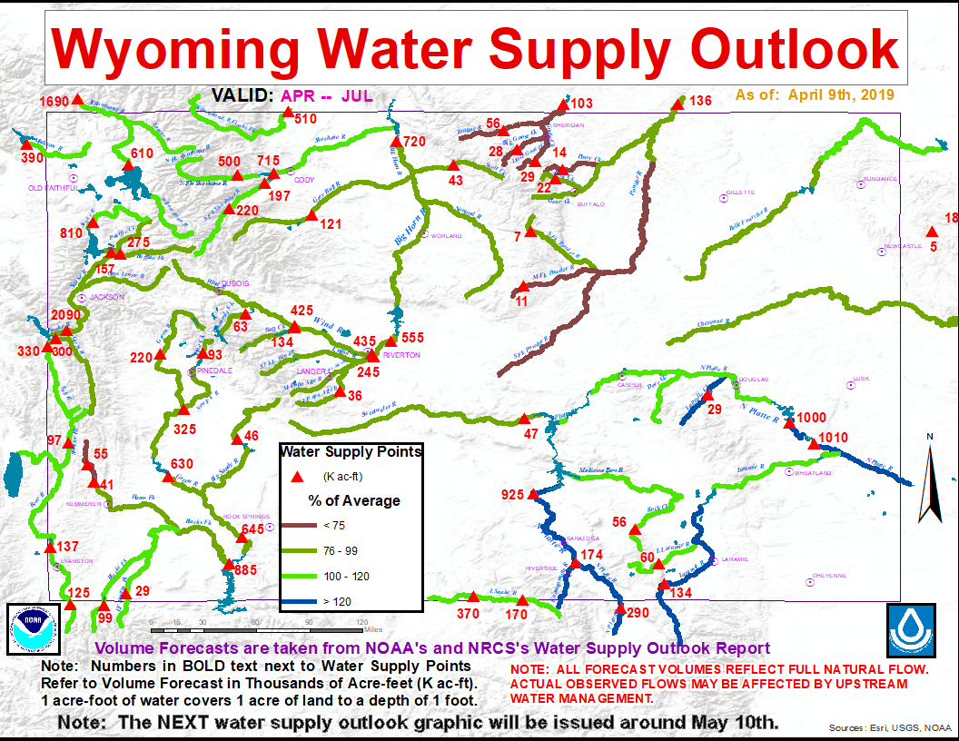
SHERIDAN, WY— The Wyoming Water Supply Outlook for the month of April released by the National Oceaniac and Atmospheric Administration (NOAA) showed that snowpack in the Bighorn Mountains was below average for this time of year.
The Tongue River Basin, which includes the entire watershed area around Sheridan and the Northern half of the Bighorn Mountains, was only at 70% of normal snowpack-water equivelent (SWE) level for April.
Jim Fahey, hydrologist for the NOAA in Riverton, said “March 2019 precipitation totals for Wyoming varied between 170 percent of normal over the Sweetwater/Lower North Platte River Drainages to near 50 percent of average over the Tongue River Basin. SWEs across basins in north central Wyoming were 70 to 90 percent of median.”
SWE’s in the Powder River Basin, which encompasses the South half of the Bighorn Mountains, as well as the area aroud Buffalo and Kaycee, were slightly better than that of the Tounge, between 76 and 99 percent of average.
According to Fahey, “Several rivers and creeks along the Tongue, Powder, and Upper Green Basins are forecasted to have below normal streamflow volumes during the upcoming snowmelt season.”
You can view the entire Water Supply Outlook for the State of Wyoming below.